Slide 0
Slide 1
Slide 2
Slide 3
Slide 4
Slide 5
Slide 6

Thai Nguyen

Area: 3,533.2 km2
Population: 1,307,871
Labour: 725,000
Number of Industrial Park: 6
Number of FDI project: 194

Strategic location

Thai Nguyen is not only a political, economic center of Viet Bac region but also of the Vietnam Northeastern mountainous, midland area; Thai Nguyen is the gateway for socio-economic exchange with the Red river delta; It borders Bac Kan Province to the North and Vinh Phuc, Tuyen Quang Province to the West and is adjacent to the East to Lang Son, Bac Giang Province and just 80Km far away from the capital of Hanoi, Vietnam

Infrastructure

Natural resources: Thai Nguyen’s total area of natural land is 356,282 hectares which is potential for developing agriculture-forestry-fishery, especially tea growing and processing. It has various kinds of mineral: it has the second largest coal deposit in the country with many coal mines and fat coal mainly found in two districts of Dai Tu and Phu Luong; the metal mines are iron, titan, tin, etc. serving the metallurgy and mineral exploitation.

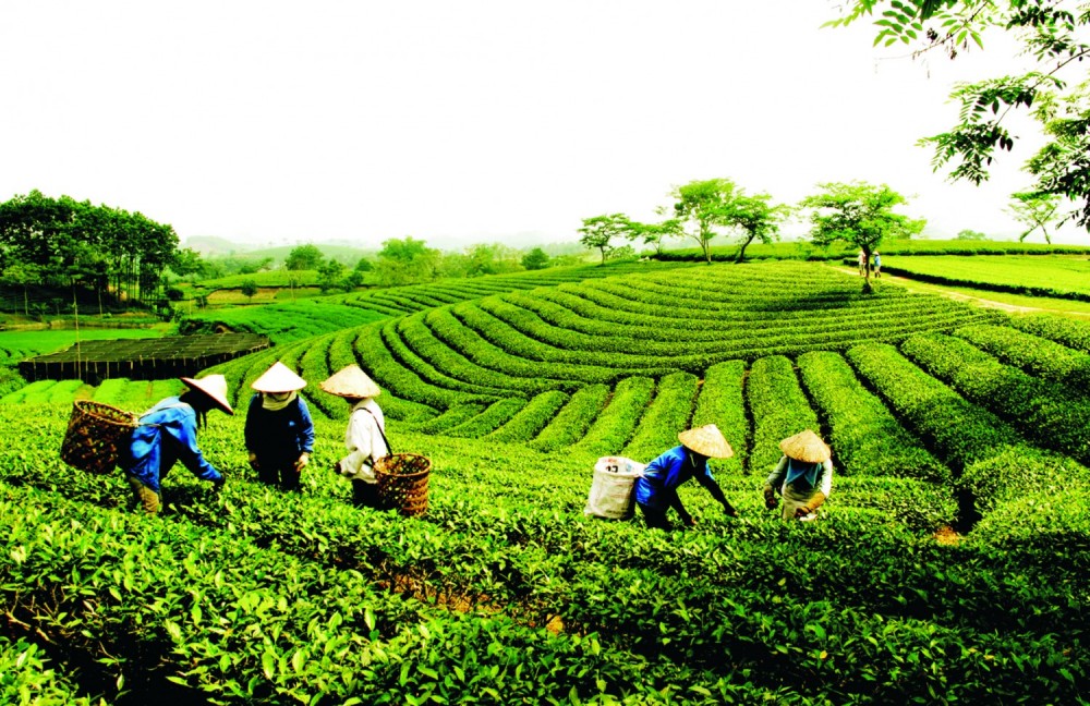
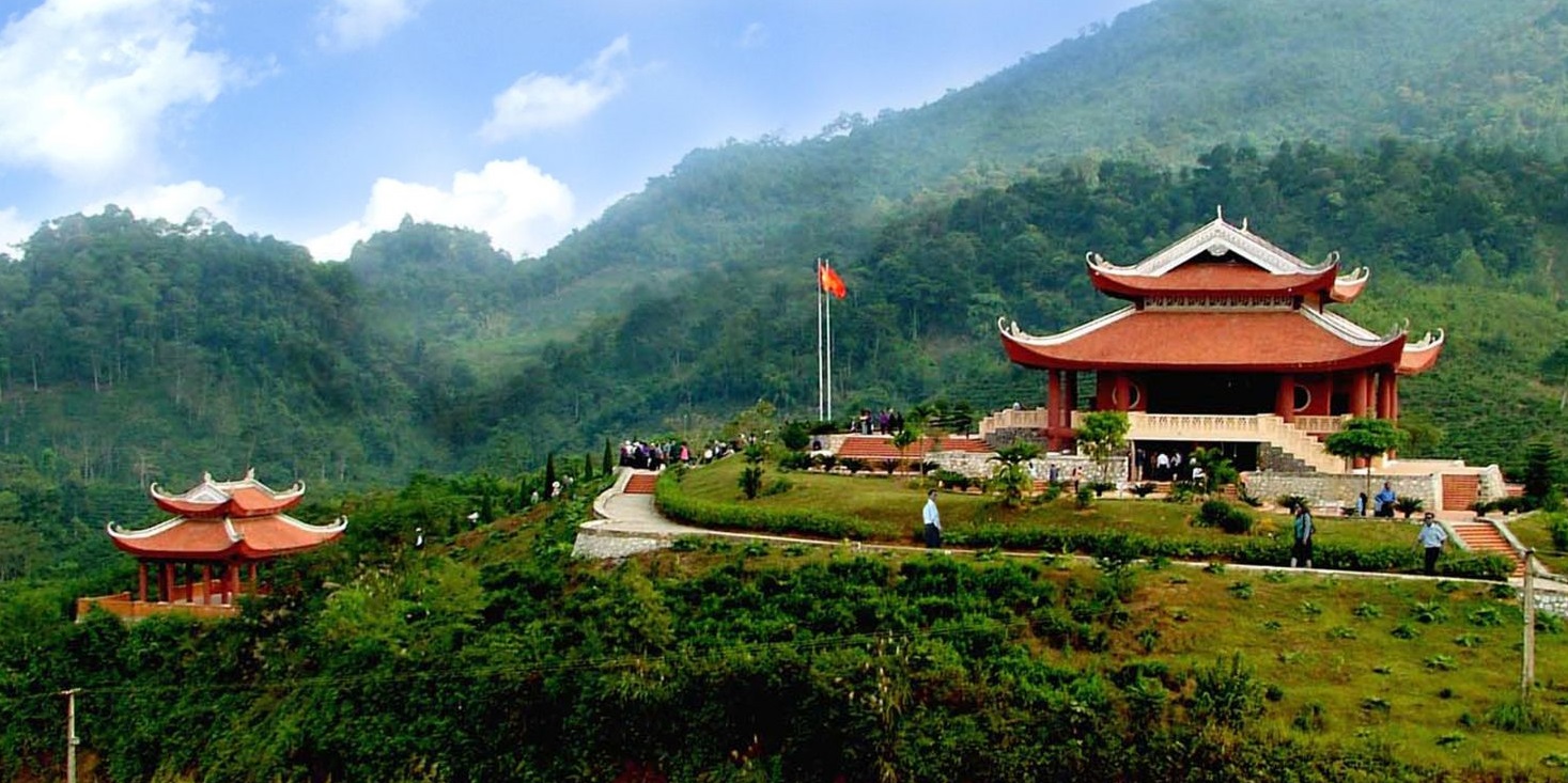
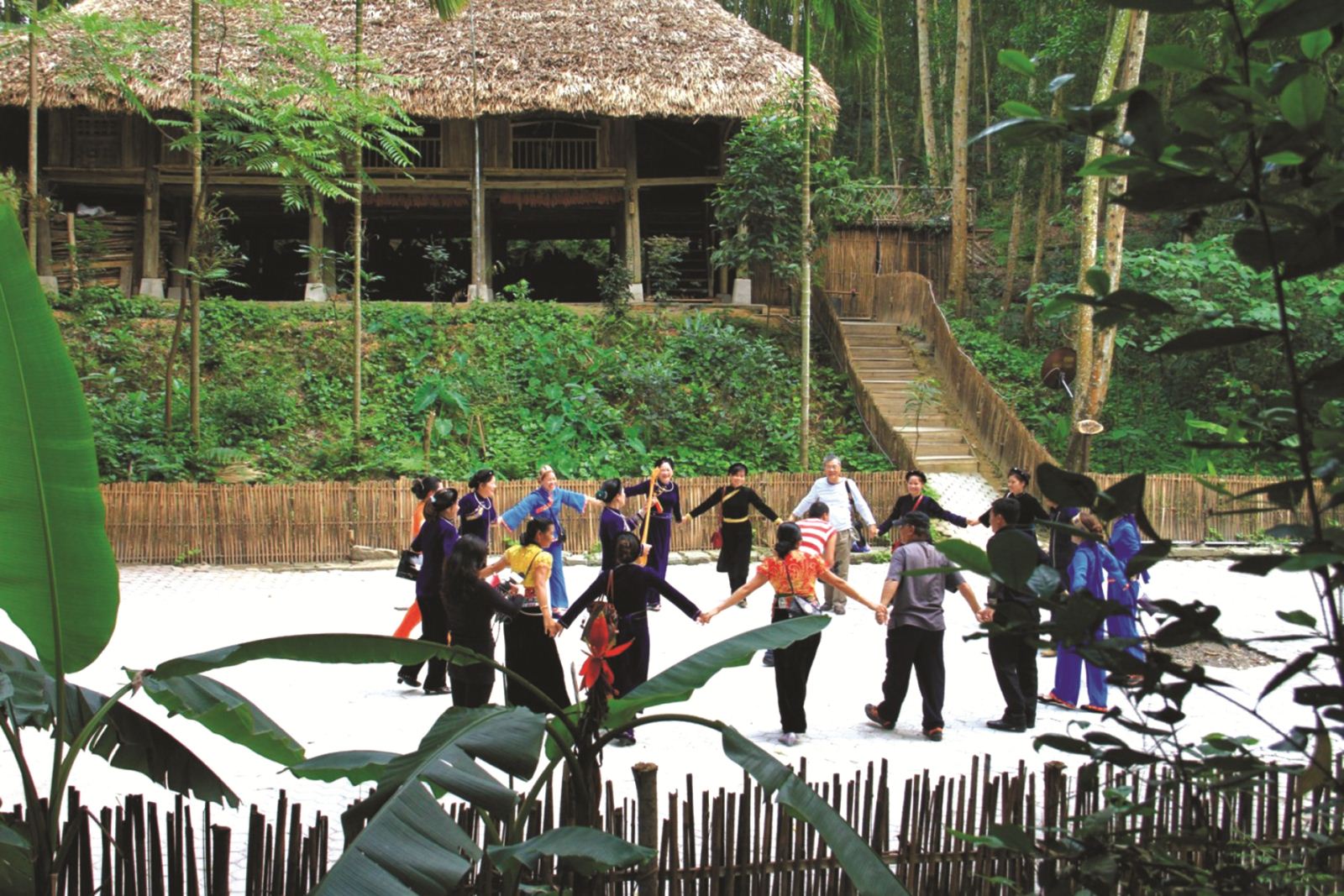
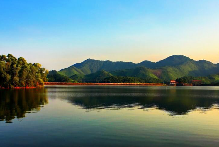
Travel resources: Thai Nguyen has numerous grandiose sceneries: Nui Coc artificial lake, Phoenix cave, Van and Vo mountain. It also attracts tourists for the reason of owning culture and historical places: culture and historical museums, architectural relics such as temple, pagoda, monument (Phuong Do temple, Doi Can temple, Duom temple, Xuong Rong temple, Hang padoga and Phu Dien pagoda) and historical relics like Viet Bac security area.

Traffic: It is convenient to travel in the province with its properly organized transportation system. Most of roads start from the axis along the national highway No. 3 running to districts, town and economic zones, mines, tourism centers and linking to neighbouring provinces. In addition, there are also national highways no. 37, 18, and 259 running through the province. Railway is also convenient here for goods and passenger transportation to other provinces such as Ha Noi – Quan Trieu route and Luu Xa

Power system: The system is quite complete with power supplied to all districts by national power network. The networks in Thai Nguyen city, Song Cong town and several districts are the best in the province.

Water system: There are water supply companies in Thai Nguyen city and Song Cong Town. The company in Thai Nguyen city has been upgraded by ADB loans with the capacity of 30,000 m3/day meeting the whole city’s demands in term of quality and quantity. The design capacity of the company in Song Cong Town is 30,000m3/day meeting the demand for water serving the development of the town and of Song Cong industrial zone but the quality of the water should be improved.

Post and Telecommunication Systems: The province has national and international post and telecommunication system with stable transmission lines of microwave, digital-electronic switchboards.

Economic overview

GDP growth rate 2021: 6.51%

Investment situation

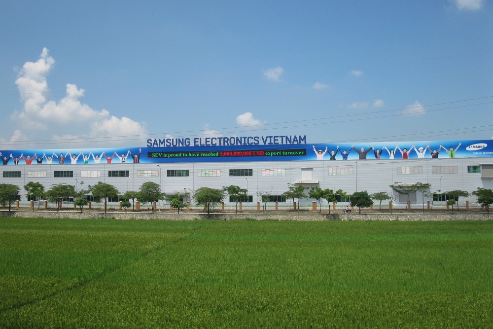
Up to now, Thai Nguyen has 194 FDI projects with the total investment capital is nearly 9.8 billion US dollars.

Attraction fields

Mineral resources mining, dairy farming, tourism, tea production, infrastructure development (education & training, health care)

Contact information

THAI NGUYEN DEPARTMENT OF PLANNING AND INVESTMENT
Add: No. 18, Nha Trang Road, Trung Vuong Ward, Thai Nguyen city, Viet Nam
Tel: (84-280) 3759605 l Fax: (84-280) 3654376
Email:  icpctng@hn.vnn.vn

THAI NGUYEN INDUSTRIAL ZONE AUTHORITY
Add: Bach Quang ward, Song Cong city, Thai Nguyen province
Tel: 02083.845 435 / Fax: 02083.845 434
Email: bbt@bqlkcnthainguyen.gov.vn / Website: http://bqlkcnthainguyen.gov.vn/

DOCUMENTS

63 PROVINCES & CITIES

Ha Noi

Ha Noi

Area: 3,324.5 km2
Population: 8,246,500
Da Nang

Da Nang

Area: 1,285.4 km2
Population: 1,134,310
Ho Chi Minh City

Ho Chi Minh City

Area: 2,095.5 km2
Population: 9,077,158
An Giang

An Giang

Area: 3,536.7 km2
Population: 1,904,532
Ba Ria - Vung Tau

Ba Ria - Vung Tau

Area: 1,989.5 km2
Population: 1,148,313
Bac Giang

Bac Giang

Area: 3,849.5 km2
Population: 1,875,238
Bac Kan

Bac Kan

Area: 4,859.4 km2
Population: 314,039
Bac Lieu

Bac Lieu

Area: 2,468.7 km2
Population: 918,207
Bac Ninh

Bac Ninh

Area: 822,7 km2
Population: 1,462,945
Ben Tre

Ben Tre

Area: 2,359.8 km2
Population: 1,288,463
Binh Dinh

Binh Dinh

Area: 6,050.6 km2
Population: 1,487,009
Binh Duong

Binh Duong

Area: 2,694.4 km2
Population: 2,627,195
Binh Phuoc

Binh Phuoc

Area: 6,871.5 km2
Population: 994,679
Binh Thuan

Binh Thuan

Area: 7,813.1 km2
Population: 1,230,808
Ca Mau

Ca Mau

Area: 5,294.9 km2
Population: 1,218,000
Can Tho

Can Tho

Area: 1,408.9 km2
Population: 1,250,792
Cao Bang

Cao Bang

Area: 6,703.4 km2
Population: 533,086
Dak Lak

Dak Lak

Area: 13,125.4 km2
Population: 1,869,322
Dak Nong

Dak Nong

Area: 6,515.6 km2
Population: 622,168
Dien Bien

Dien Bien

Area: 9.560 km²
Population: 613,500
Dong Nai

Dong Nai

Area: 5,907.2 km2
Population: 3,097,107
Dong Thap

Dong Thap

Area: 3,378.8 km2
Population: 1,693,300
Gia Lai

Gia Lai

Area: 15,536.9 km2
Population: 1,541,829
Ha Giang

Ha Giang

Area: 7,914.9 km2
Population: 854,679
Ha Nam

Ha Nam

Area: 862 km2
Population: 883,927
Ha Tinh

Ha Tinh

Area: 6,055.6 km2
Population: 1,288,866
Hai Duong

Hai Duong

Area: 1,656 km2
Population: 1,936,774
Hai Phong

Hai Phong

Area: 1,527.4 km2
Population: 2,028,514
Hau Giang

Hau Giang

Area: 1,602.4 km2
Population: 726,792
Hoa Binh

Hoa Binh

Area: 4,608.7 km2
Population: 854,131
Hung Yen

Hung Yen

Area: 926 km2
Population: 1,269,090
Khanh Hoa

Khanh Hoa

Area: 5,217.7 km2
Population: 1,231,107
Kien Giang

Kien Giang

Area: 6,348.5 km2
Population: 2.109.000
Kon Tum

Kon Tum

Area: 9,689.6 km2
Population: 561,742
Lai Chau

Lai Chau

Area: 9,068.8 km2
Population: 460,196
Lam Dong

Lam Dong

Area: 9,773.5 km2
Population: 1,415,500
Lang Son

Lang Son

Area: 8,320.8 km2
Population: 781,655
Lao Cai

Lao Cai

Area: 6,383.9 km2
Population: 730,420
Long An

Long An

Area: 4,495 km2
Population: 1,688,547
Nam Dinh

Nam Dinh

Area: 1,653.2 km2
Population: 1,826.269
Nghe An

Nghe An

Area: 16,490 km2
Population: 3,327,791
Ninh Binh

Ninh Binh

Area: 1,377.6 km2
Population: 993,920
Ninh Thuan

Ninh Thuan

Area: 3,358.3 km2
Population: 595,000
Phu Tho

Phu Tho

Area: 3,533.3 km2
Population: 1,463,726
Phu Yen

Phu Yen

Area: 5,060.6 km2
Population: 961,152
Quang Binh

Quang Binh

Area: 8,065.3 km2
Population: 895,430
Quang Nam

Quang Nam

Area: 10,438.4 km2
Population: 1,495,812
Quang Ngai

Quang Ngai

Area: 5,152.7 km2
Population: 1,246,000
Quang Ninh

Quang Ninh

Area: 6,102 km2
Population: 1,321,149
Quang Tri

Quang Tri

Area: 4,739.8 km2
Population: 632,375
Soc Trang

Soc Trang

Area: 3,311.6 km2
Population: 1,621,000
Son La

Son La

Area: 14,174.4 km2
Population: 1,248,415
Tay Ninh

Tay Ninh

Area: 4,032.6 km2
Population: 1,178,329
Thai Binh

Thai Binh

Area: 1,570.8 km2
Population: 1,860,447
Thai Nguyen

Thai Nguyen

Area: 3,533.2 km2
Population: 1,307,871
Thanh Hoa

Thanh Hoa

Area: 11,129.5 km2
Population: 3,664.900
Thua Thien Hue

Thua Thien Hue

Area: 5,033.2 km2
Population: 1,133.700
Tien Giang

Tien Giang

Area: 2,509.3 km2
Population: 1,772,785
Tra Vinh

Tra Vinh

Area: 2,341.2 km2
Population: 1,009,168
Tuyen Quang

Tuyen Quang

Area: 8,065.3 km2
Population: 784,811
Vinh Long

Vinh Long

Area: 1,520.2 km2
Population: 1,022,791
Vinh Phuc

Vinh Phuc

Area: 1,237.5 km2
Population: 1,151,154
Yen Bai

Yen Bai

Area: 6,886.3 km2
Population: 876,041

Provincial Investment Promotion Agencies