Slide 0
Slide 1
Slide 2
Slide 3
Slide 4

Cao Bang

Area: 6,703.4 km2
Population: 533,086
Labour: 36,000
Number of Industrial Park: 1
Number of FDI project: 17

Strategic location

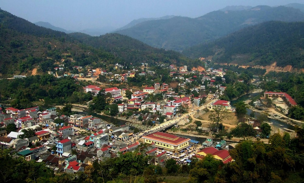
Cao Bang is located in the northeastern Vietnam, sharing a 322km long borderline with Guang Xi province (China) in the north and northeast, bordering Tuyen Quang and Ha Giang in the west, and Bac Kan and Lang Son in the south.

Infrastructure

Natural resources: Soil is a valuable resource to develop the economy of Cao Bang province. The province has 140,942 hectares of soils which can be used for agriculture, 408/705 hectares of soils which can be used for forestry. Many precious kinds of wood (bassia, sapan-wood, etc) and animals (bear, deer, stag, etc) can be found in Cao Bang’s forests. Cao Bang has plentiful and diversifies mineral resources with 142 mines and ore points including 22 different types of minerals such as tin, vonfram, gold, lead, zin

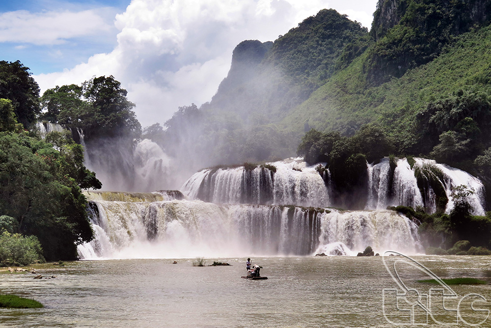
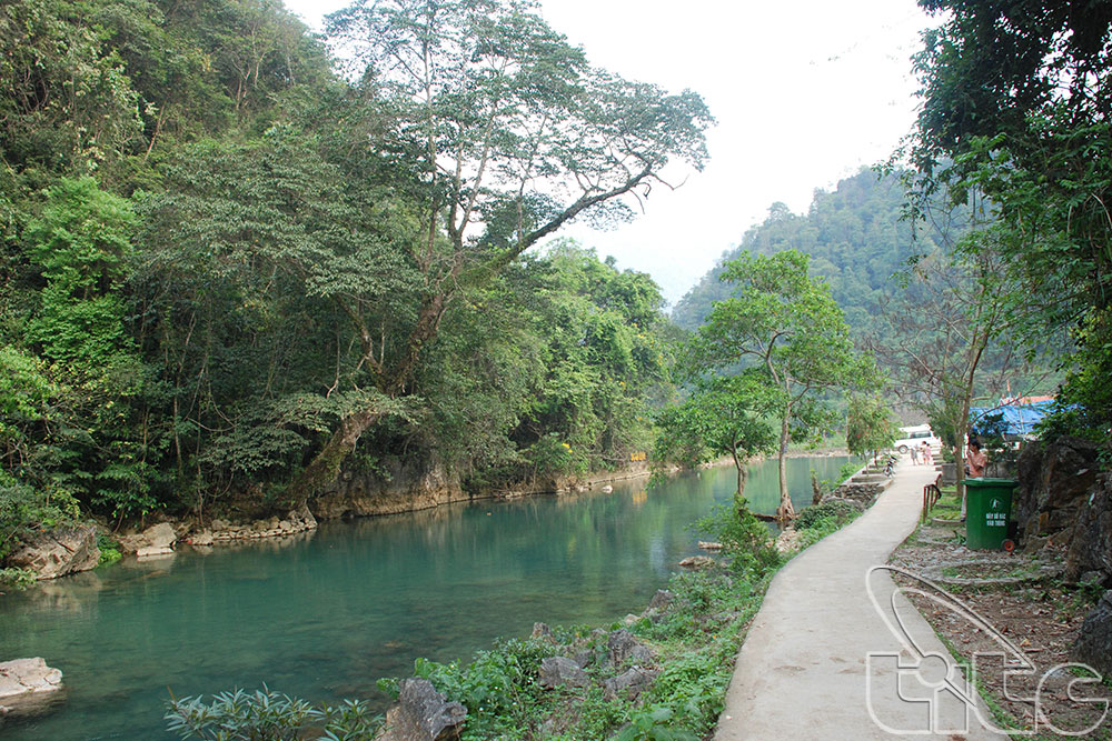
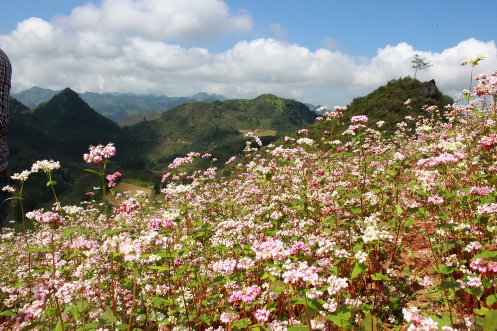
Travel resources: Cao Bang has not only many famous landscapes such as Ban Gioc water-fall Nguom Ngao cave, Thang Hen lake and Phia Oac mountain peak with 1931m heigh but also numerous ranked historical places like Pac Bo historical complex where Uncle Ho lived after 30 years overseas; Tran Hung Dao forest where original Vietnam army was established; Dong Khe historical complex and Underground Fortress of Cao Bang town. With the great potential, Cao Bang could develop various kinds of tourism.

Traffic: Cao Bang has rather complicated topography. It has only 1 way of transportation which is road one with 4 national lines: National highways No. 3, 4A, 34 and 4C in which National highways No 3 and 4 were improved. Provincial road has 9 main lines and 2 branch lines and most of them meet the V standard for mountainous areas. 100% roads to town center were standard based on the standard for rural roads.

Power system: Cao Bang’s power authority is currently in charge of managing approx. 85km of 110kV power network, more than 600km of 35kV power network. Besides national power network, Cao Bang has developed its own such as Cun stream hydroelectricity plant in Cao Bang town, Na Tau hydroelectricity plant in Quang Hoa district, etc. The province is constructing Na Loa hydroelectricity plant which is the ever largest hydroelectricity plant of the province to serve local household and production needs.

Water system: Cao Bang town is supply water by a water treatment station using French technology and other townlets were supplied by gravity water supplies. The percentage of town population using clean water was 50% in 2010.

Post and Telecommunication Systems: Cao Bang’s post and telecommunication system has been gradually developed. Mobile phone waves was covered all province even low areas. The ratio of telephone per 100 population increase rapidly and is estimated to reach 85 in 2010. - Industrial zones: De Tham industrial zone in Cao Bang with planned 92,21 hectares is being leveled in the first phrase.

System of ndustrial Zone: Cao Bang has 3 border-gate economic zones which are Ta Lung, Tra Linh, Soc Giang. It is planned to 2011-2020 that Ta Lung and Tra Linh will be international border-gate and Soc Giang will be main border-gate of Cao Bang

Economic overview

GDP growth rate 2021: 3.33%

Investment situation

Up to now, Cao Bang has 17 FDI projects with the total investment capital is about 36.43 million US dollars.

Attraction fields

Infrastructure development; tourism & service, high-tech industry, education & trainning, high-tech agriculture

Contact information

CAO BANG DEPARTMENT OF PLANNING AND INVESTMENT
Add: No. 30 Xuan Truong street, Hop Giang Ward, Cao Bang city
Tel: (84-206) 3852182 l Fax: (84-206) 3647120
Email:  sokhdt@caobang.gov.vn

CAO BANG ECONOMIC ZONES AUTHORITY
Add: No. 052 , Kim Dong Street, Hop Giang Ward, Cao Bang city  
Tel: (84-206) 3854 529   - Fax: (84-206) 3854 929
Email: bqlkkt@caobang.gov.vn


DOCUMENTS

63 PROVINCES & CITIES

Ha Noi

Ha Noi

Area: 3,324.5 km2
Population: 8,246,500
Da Nang

Da Nang

Area: 1,285.4 km2
Population: 1,134,310
Ho Chi Minh City

Ho Chi Minh City

Area: 2,095.5 km2
Population: 9,077,158
An Giang

An Giang

Area: 3,536.7 km2
Population: 1,904,532
Ba Ria - Vung Tau

Ba Ria - Vung Tau

Area: 1,989.5 km2
Population: 1,148,313
Bac Giang

Bac Giang

Area: 3,849.5 km2
Population: 1,875,238
Bac Kan

Bac Kan

Area: 4,859.4 km2
Population: 314,039
Bac Lieu

Bac Lieu

Area: 2,468.7 km2
Population: 918,207
Bac Ninh

Bac Ninh

Area: 822,7 km2
Population: 1,462,945
Ben Tre

Ben Tre

Area: 2,359.8 km2
Population: 1,288,463
Binh Dinh

Binh Dinh

Area: 6,050.6 km2
Population: 1,487,009
Binh Duong

Binh Duong

Area: 2,694.4 km2
Population: 2,627,195
Binh Phuoc

Binh Phuoc

Area: 6,871.5 km2
Population: 994,679
Binh Thuan

Binh Thuan

Area: 7,813.1 km2
Population: 1,230,808
Ca Mau

Ca Mau

Area: 5,294.9 km2
Population: 1,218,000
Can Tho

Can Tho

Area: 1,408.9 km2
Population: 1,250,792
Cao Bang

Cao Bang

Area: 6,703.4 km2
Population: 533,086
Dak Lak

Dak Lak

Area: 13,125.4 km2
Population: 1,869,322
Dak Nong

Dak Nong

Area: 6,515.6 km2
Population: 622,168
Dien Bien

Dien Bien

Area: 9.560 km²
Population: 613,500
Dong Nai

Dong Nai

Area: 5,907.2 km2
Population: 3,097,107
Dong Thap

Dong Thap

Area: 3,378.8 km2
Population: 1,693,300
Gia Lai

Gia Lai

Area: 15,536.9 km2
Population: 1,541,829
Ha Giang

Ha Giang

Area: 7,914.9 km2
Population: 854,679
Ha Nam

Ha Nam

Area: 862 km2
Population: 883,927
Ha Tinh

Ha Tinh

Area: 6,055.6 km2
Population: 1,288,866
Hai Duong

Hai Duong

Area: 1,656 km2
Population: 1,936,774
Hai Phong

Hai Phong

Area: 1,527.4 km2
Population: 2,028,514
Hau Giang

Hau Giang

Area: 1,602.4 km2
Population: 726,792
Hoa Binh

Hoa Binh

Area: 4,608.7 km2
Population: 854,131
Hung Yen

Hung Yen

Area: 926 km2
Population: 1,269,090
Khanh Hoa

Khanh Hoa

Area: 5,217.7 km2
Population: 1,231,107
Kien Giang

Kien Giang

Area: 6,348.5 km2
Population: 2.109.000
Kon Tum

Kon Tum

Area: 9,689.6 km2
Population: 561,742
Lai Chau

Lai Chau

Area: 9,068.8 km2
Population: 460,196
Lam Dong

Lam Dong

Area: 9,773.5 km2
Population: 1,415,500
Lang Son

Lang Son

Area: 8,320.8 km2
Population: 781,655
Lao Cai

Lao Cai

Area: 6,383.9 km2
Population: 730,420
Long An

Long An

Area: 4,495 km2
Population: 1,688,547
Nam Dinh

Nam Dinh

Area: 1,653.2 km2
Population: 1,826.269
Nghe An

Nghe An

Area: 16,490 km2
Population: 3,327,791
Ninh Binh

Ninh Binh

Area: 1,377.6 km2
Population: 993,920
Ninh Thuan

Ninh Thuan

Area: 3,358.3 km2
Population: 595,000
Phu Tho

Phu Tho

Area: 3,533.3 km2
Population: 1,463,726
Phu Yen

Phu Yen

Area: 5,060.6 km2
Population: 961,152
Quang Binh

Quang Binh

Area: 8,065.3 km2
Population: 895,430
Quang Nam

Quang Nam

Area: 10,438.4 km2
Population: 1,495,812
Quang Ngai

Quang Ngai

Area: 5,152.7 km2
Population: 1,246,000
Quang Ninh

Quang Ninh

Area: 6,102 km2
Population: 1,321,149
Quang Tri

Quang Tri

Area: 4,739.8 km2
Population: 632,375
Soc Trang

Soc Trang

Area: 3,311.6 km2
Population: 1,621,000
Son La

Son La

Area: 14,174.4 km2
Population: 1,248,415
Tay Ninh

Tay Ninh

Area: 4,032.6 km2
Population: 1,178,329
Thai Binh

Thai Binh

Area: 1,570.8 km2
Population: 1,860,447
Thai Nguyen

Thai Nguyen

Area: 3,533.2 km2
Population: 1,307,871
Thanh Hoa

Thanh Hoa

Area: 11,129.5 km2
Population: 3,664.900
Thua Thien Hue

Thua Thien Hue

Area: 5,033.2 km2
Population: 1,133.700
Tien Giang

Tien Giang

Area: 2,509.3 km2
Population: 1,772,785
Tra Vinh

Tra Vinh

Area: 2,341.2 km2
Population: 1,009,168
Tuyen Quang

Tuyen Quang

Area: 8,065.3 km2
Population: 784,811
Vinh Long

Vinh Long

Area: 1,520.2 km2
Population: 1,022,791
Vinh Phuc

Vinh Phuc

Area: 1,237.5 km2
Population: 1,151,154
Yen Bai

Yen Bai

Area: 6,886.3 km2
Population: 876,041

Provincial Investment Promotion Agencies