Please Login to use our services.
If you are not our member, please register here or contact us via email support@ipavietnam.org for our further support.


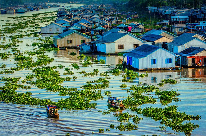
An Giang Province is located to the west of the Mekong Delta between the Tien and Hau rivers and shares a 100km border with Cambodia in the north- west. It also shares border with Dong Thap Province in the east, Can Tho City in the south-east, and Kien Giang Province in the south-west.An Giang Province is located to the west of the Mekong Delta between the Tien and Hau rivers and shares a 100km border with Cambodia in the north- west. It also shares border with Dong Thap Province in the east, Can Tho City in the south-east, and Kien Giang Province in the south-west.
Natural resources: + Land resources: An Giang is a province in the Mekong watershed, is one of the provinces with the largest arable land in the Mekong Delta. The total area is 246 821 hectares of agricultural land, including paddy land occupies more than 82%. An Giang land formed during disputes between the sea and rivers, it is very diverse. Each of the sediments in different environments will create a different soil, with changes in soil quality, topography, ecology and farming practices. + Natural resources: An Giang province rich in minerals: building materials (building stone, granite, eruption, building sand, clay bricks and tiles), decorative materials (stone tiling, stone aplite), minerals fuels (peat), gems and pearls, metal ore (molybdenum ore, manganese mines), natural mineral water.
Traffic: + Road: * Name and number Highway passing: 4 online + Highway 91 goes from Cần Thơ to An Giang over the border to Cambodia in Tịnh Biên, length 93.13 km. + N1 Highway passing down the Vĩnh Tế canal town of Tịnh Biên, An Nông commune (Tịnh Biên) and Lạc Quới, Vĩnh Gia (Tri Tôn), connecting two provinces of An Giang - Kiên Giang, two international border gates Tịnh Biên (An Giang province) and Sà Xía (Kiên Giang) has been invested, upgrades, attract tourists with 23km long. + Highway 91C, running was upgraded from Provincial Highway 956 has a total length of 35.5 km, with the beginning of the highway at Km 117 + 000 91 located in the inner town of Châu Đốc, the link connecting Long Bình Bridge, An Phú district. + Highway 80 goes through Phú Thuận Commune, Thoại Sơn districts: 1.2 km. * The name and number of the provincial road: The province has 14 provincial roads with a total length of 394km and 94 bridges with a total length of 3499 m, including 338 km road standard level 4 and 56 km road level 5. * Orientations to 2030: + Railways: No. * The name and number of the National Railway runs through:
Power system: - Power stations of 110KV, 220KV: 6097 substations. - Electricity prices, installation services, repair: + Normal hours: 1.388 dong/kwh + Few people use: 869 dong/kwh + Rush hour: 2.459 dong/kwh
Water system: - Water plant: 198 - Capacity m3 / day: 194.282 m3/day - Response to industrial parks, residential areas: 97,58% - Waste treatment systems and wastewater: + For waste: No * Waste treatment plants: No - An Giang Province has planned three clusters concentrated waste treatment: Bình Hòa - Châu Thành district (23ha), Phú Thạnh - Phú Tân district (13 hectares), Châu Đốc (16 ha). Currently only landfill in Châu Đốc is hygienic. - In addition, 8 models of rural waste treatment (treatment by composting method) with a capacity of 3-5 tons / day. + For wastewater: * 2 water treatment factories in urban areas, 01 wastewater treatment plants in Industrial Park (under construction), 04 wastewater treatment zones in residential living. - Waste water treatment system in Long Xuyên city (under construction): 30,000 m³ / day; - Waste water treatment system in Sam Mountain - Châu Đốc: 2,000 m³ / day; - Wastewater treatment system in Bình Hòa Industrial Park (under construction): 2,000 m³ / day; - Waste water treatment system in Châu Đốc Residential area: 5,000 m³ / day; - Waste water treatment system in Sao Mai Bình Khánh 3 Residential area: 920 m³ / day; - Waste water treatment system in Sao Mai Tịnh Biên Residential area: 450 m³ / day; - Waste water treatment system in Sao Mai Châu Phú Residential area: 500 m³ / day.
GDP growth rate 2021: 2.15%
Up to now, An Giang has 29 FDI projects with the total investment capital is nearly 281 million US dollars.
Infrastructure, health-care service, environment protection, food-processing, textile, consumer products, supporting industry, service, finance, energy.
AN GIANG DEPARTMENT OF PLANNING AND INVESTMENT
Add: No. 03 Le Trieu Kiet, My Binh Ward, Long Xuyen city, An Giang
Tel: (84) 763.852.913 l Fax: (84) 763.853.380
Email: sokhdt@angiang.gov.vn
AN GIANG ECONOMIC ZONE AUTHORITY
Add: No 02, Street 20, My Hoa Ward, Long Xuyen City, An Giang
Tel: (84-296)3952.656
Email: banqlkkt@angiang.gov.vn
AN GIANG TRADE AND INVESTMENT PROMOTION CENTER
Add: No 2A, Ngo Gia Tu street, My Long Ward, Long Xuyen city, An Giang province.
Tell: (84-296) 3945001. Fax: (84-296) 3945002
Email:ttxttmdldt@angiang.gov.vn