Slide 0
Slide 1
Slide 2
Slide 3
Slide 4

Dong Thap

Area: 3,378.8 km2
Population: 1,693,300
Labour: 1,017,000
Number of Industrial Park: 7
Number of FDI project: 22

Strategic location

Dong Thap is on the Mekong Delta, one of three Dong Thap Muoi's provinces. It shares its border with Cambodia on the north, Vinh Long Province and Can Tho City on the south, An Giang Province on the west and Long An, Tien Giang provinces on the east.

Infrastructure

Natural resources: - Forest resource : 6.534 ha - Sea resource, surface water: - Dong Thap Province Tien River flows through. The northern part of the Tien River has two creeks: So Ha river and So Thuong river, deriving from Cambodia flow through Tien Rivera at Hong Ngu ; The southern part of the Tien River has Cai Tau River , Cai Tau Thuong , Sa Dec River poured into Tien river in Chau Thanh district and the city of Sa Dec ... Southern Tien River region has crisscrossed canals . The whole province has fresh water source from begin to the end of year. 7.3. Mineral resources: Clay for brick and tile reserves of 68 million m3, construction sand reserves of 50 million m3, peat reserves of 2 million m3, Kaolin clay used in industrial porcelain, art pottery reserves are large

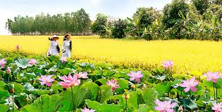
Travel resources:  Generous natural conditions and submerged in-land ecosystem have awarded Dong Thap with multiple valuable ecotourism resources.

Traffic: - Road way: + Many national roads go through Dong Thap, totaling 3,402km of roads as of now. The N2 route to be completed in a near future will wake up Dong Thap Muoi economic potentiality and Cao Lanh bridge as well as Vam Cong bridge upon its construction will also stimulate the economy to grow. Existing National roads No.30, No.80 and No.54 together with Ho Chi Minh Highway passing the provincial centre over Tien River and connecting Mekong Delta provinces create an advantage in road traffic to Ho Chi Minh City, Can Tho and other provinces in the region. + With a 48km-long border with the neighboring Cambodia and 7 border gates of which there are 2 international gates of Thuong Phuoc and Dinh Ba, Dong Thap is concentrating on investing to exploit border economic advantages so as to contribute to develop trade and services and boost the local economy. - Water traffic: + Tien River and Hau River have helped vessel traffic of the province to become straight-through. The Cao Lanh and Sa Dec terminals along Tien River are capable of accepting vessels of up to 5,000DWT in size, facilitating goods transportation across South East Asia Sea and Cambodia.

Power system: Two main sources: Cai Lay transformer station 220 Kv and Tra Noc thermal factory.

Water system: Having 20 urban water factory, 305 supply water station, 8.000 wells with hand pump. - (Wastewater) waste treatment system: Total area of about 16 ha

Economic overview

GDP growth rate 2021: -1.76%

Investment situation

Up to now, Dong Thap has 22 FDI projects with the total investment capital is about 233 million US dollars.

Attraction fields

High-tech agriculture, infrastructure development, agricultural processing, retails, supporting industry.

Contact information

DONG THAP DEPARTMENT OF PLANNING AND INVESTMENT
Add: No. 11, Vo Truong Toan Road, Ward 1, Cao Lanh city, Dong Thap
Tel: (84) 67.3851101 l Fax: (84) 67.3852955
Email:  skhdt@dongthap.gov.vn

DONG THAP ECONOMIC ZONES AUTHORITY
Add: No 10 Le Van Chanh, Ward 1, Cao Lanh City, Dong Thap province
Tel: 0277.3878471
Email: bqlkkt@dongthap.gov.vn

DONG THAP PROMOTION, TRADING AND INVESTMENT CENTER
Add: No 1 Nguyen Van Bieu street, My Phu Ward, Cao Lanh city, Dong Thap province.
Tel: 067. 3878389 - 3853382
Fax: 067. 3853381

DOCUMENTS

63 PROVINCES & CITIES

Ha Noi

Ha Noi

Area: 3,324.5 km2
Population: 8,246,500
Da Nang

Da Nang

Area: 1,285.4 km2
Population: 1,134,310
Ho Chi Minh City

Ho Chi Minh City

Area: 2,095.5 km2
Population: 9,077,158
An Giang

An Giang

Area: 3,536.7 km2
Population: 1,904,532
Ba Ria - Vung Tau

Ba Ria - Vung Tau

Area: 1,989.5 km2
Population: 1,148,313
Bac Giang

Bac Giang

Area: 3,849.5 km2
Population: 1,875,238
Bac Kan

Bac Kan

Area: 4,859.4 km2
Population: 314,039
Bac Lieu

Bac Lieu

Area: 2,468.7 km2
Population: 918,207
Bac Ninh

Bac Ninh

Area: 822,7 km2
Population: 1,462,945
Ben Tre

Ben Tre

Area: 2,359.8 km2
Population: 1,288,463
Binh Dinh

Binh Dinh

Area: 6,050.6 km2
Population: 1,487,009
Binh Duong

Binh Duong

Area: 2,694.4 km2
Population: 2,627,195
Binh Phuoc

Binh Phuoc

Area: 6,871.5 km2
Population: 994,679
Binh Thuan

Binh Thuan

Area: 7,813.1 km2
Population: 1,230,808
Ca Mau

Ca Mau

Area: 5,294.9 km2
Population: 1,218,000
Can Tho

Can Tho

Area: 1,408.9 km2
Population: 1,250,792
Cao Bang

Cao Bang

Area: 6,703.4 km2
Population: 533,086
Dak Lak

Dak Lak

Area: 13,125.4 km2
Population: 1,869,322
Dak Nong

Dak Nong

Area: 6,515.6 km2
Population: 622,168
Dien Bien

Dien Bien

Area: 9.560 km²
Population: 613,500
Dong Nai

Dong Nai

Area: 5,907.2 km2
Population: 3,097,107
Dong Thap

Dong Thap

Area: 3,378.8 km2
Population: 1,693,300
Gia Lai

Gia Lai

Area: 15,536.9 km2
Population: 1,541,829
Ha Giang

Ha Giang

Area: 7,914.9 km2
Population: 854,679
Ha Nam

Ha Nam

Area: 862 km2
Population: 883,927
Ha Tinh

Ha Tinh

Area: 6,055.6 km2
Population: 1,288,866
Hai Duong

Hai Duong

Area: 1,656 km2
Population: 1,936,774
Hai Phong

Hai Phong

Area: 1,527.4 km2
Population: 2,028,514
Hau Giang

Hau Giang

Area: 1,602.4 km2
Population: 726,792
Hoa Binh

Hoa Binh

Area: 4,608.7 km2
Population: 854,131
Hung Yen

Hung Yen

Area: 926 km2
Population: 1,269,090
Khanh Hoa

Khanh Hoa

Area: 5,217.7 km2
Population: 1,231,107
Kien Giang

Kien Giang

Area: 6,348.5 km2
Population: 2.109.000
Kon Tum

Kon Tum

Area: 9,689.6 km2
Population: 561,742
Lai Chau

Lai Chau

Area: 9,068.8 km2
Population: 460,196
Lam Dong

Lam Dong

Area: 9,773.5 km2
Population: 1,415,500
Lang Son

Lang Son

Area: 8,320.8 km2
Population: 781,655
Lao Cai

Lao Cai

Area: 6,383.9 km2
Population: 730,420
Long An

Long An

Area: 4,495 km2
Population: 1,688,547
Nam Dinh

Nam Dinh

Area: 1,653.2 km2
Population: 1,826.269
Nghe An

Nghe An

Area: 16,490 km2
Population: 3,327,791
Ninh Binh

Ninh Binh

Area: 1,377.6 km2
Population: 993,920
Ninh Thuan

Ninh Thuan

Area: 3,358.3 km2
Population: 595,000
Phu Tho

Phu Tho

Area: 3,533.3 km2
Population: 1,463,726
Phu Yen

Phu Yen

Area: 5,060.6 km2
Population: 961,152
Quang Binh

Quang Binh

Area: 8,065.3 km2
Population: 895,430
Quang Nam

Quang Nam

Area: 10,438.4 km2
Population: 1,495,812
Quang Ngai

Quang Ngai

Area: 5,152.7 km2
Population: 1,246,000
Quang Ninh

Quang Ninh

Area: 6,102 km2
Population: 1,321,149
Quang Tri

Quang Tri

Area: 4,739.8 km2
Population: 632,375
Soc Trang

Soc Trang

Area: 3,311.6 km2
Population: 1,621,000
Son La

Son La

Area: 14,174.4 km2
Population: 1,248,415
Tay Ninh

Tay Ninh

Area: 4,032.6 km2
Population: 1,178,329
Thai Binh

Thai Binh

Area: 1,570.8 km2
Population: 1,860,447
Thai Nguyen

Thai Nguyen

Area: 3,533.2 km2
Population: 1,307,871
Thanh Hoa

Thanh Hoa

Area: 11,129.5 km2
Population: 3,664.900
Thua Thien Hue

Thua Thien Hue

Area: 5,033.2 km2
Population: 1,133.700
Tien Giang

Tien Giang

Area: 2,509.3 km2
Population: 1,772,785
Tra Vinh

Tra Vinh

Area: 2,341.2 km2
Population: 1,009,168
Tuyen Quang

Tuyen Quang

Area: 8,065.3 km2
Population: 784,811
Vinh Long

Vinh Long

Area: 1,520.2 km2
Population: 1,022,791
Vinh Phuc

Vinh Phuc

Area: 1,237.5 km2
Population: 1,151,154
Yen Bai

Yen Bai

Area: 6,886.3 km2
Population: 876,041

Provincial Investment Promotion Agencies