Slide 0
Slide 1
Slide 2
Slide 3
Slide 4

Lang Son

Area: 8,320.8 km2
Population: 781,655
Labour: 508,000
Number of Industrial Park: 2
Number of FDI project: 42

Strategic location

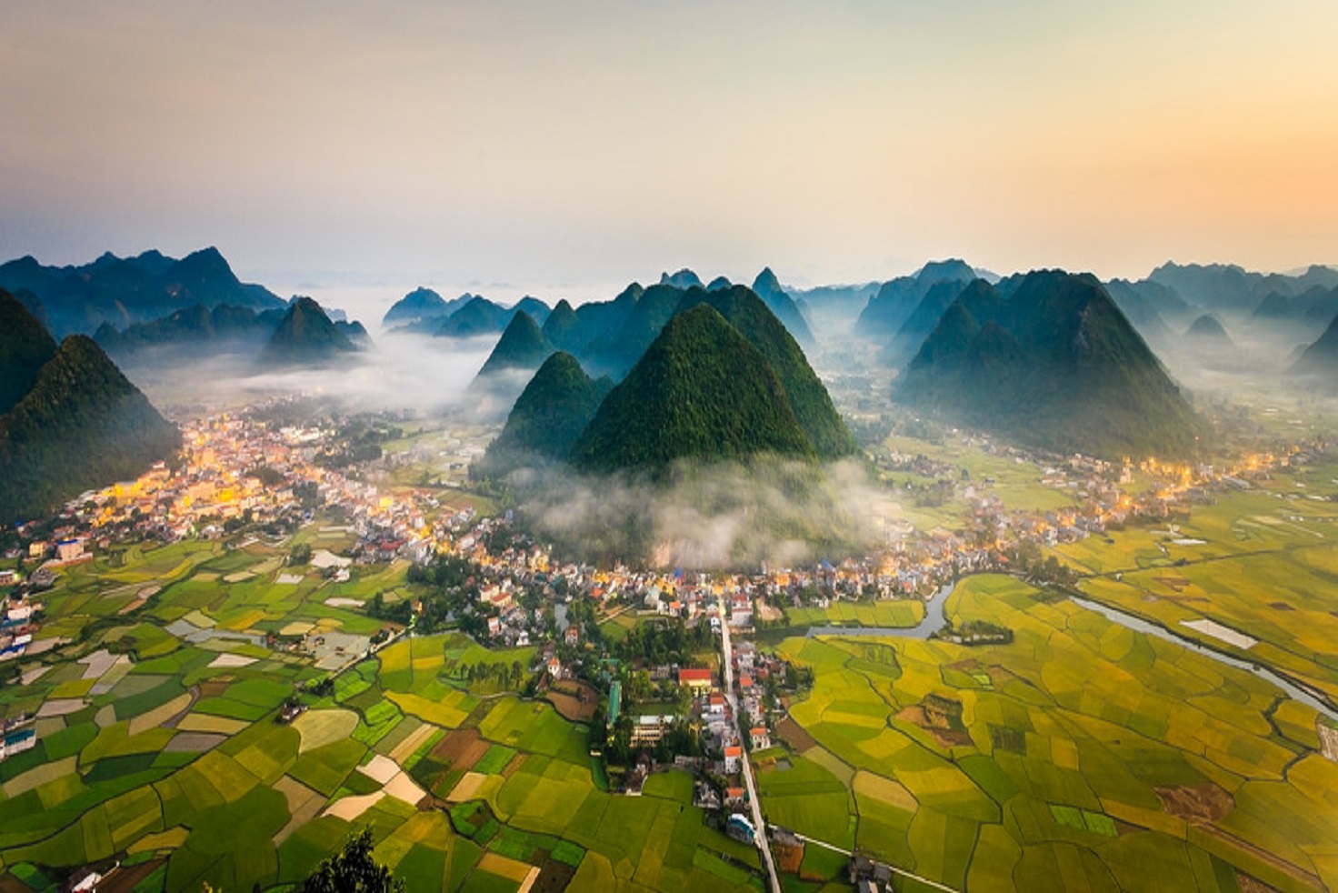
Lang Son is a frontier mountainous province in the North-East of Vietnam. It shares border with Cao Bang Province on the south, Bac Giang Province on the north, Guangxi (China) on the east, Quang Ninh Province on the north-east and Bac Kan, Thai Nguyen provinces on the west.

Infrastructure

Natural resources: - Geographic political position of Lang Son towards the Northeast region and the country has advantages compared with the northern mountainous provinces. The world economic integration will create favorable conditions for Lang Son to promote its economy, commerce, tourism and services concurrently expand the industrial development, especially hi-tech industry (electronic assembly), food processing industry, auxiliary industry and processing and package for export, etc. - Water surface resources

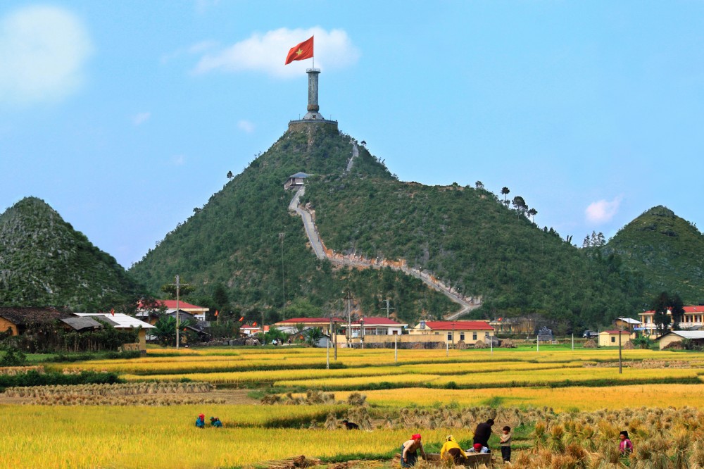
Travel resources: Lang Son which is located in the northern border area has convenient transportation to connect to Hanoi. Lang Son has many places of interest such as Ky Lua market street, Stone statue of Lady To Thi, Tam Thanh pagoda, Nhi Thanh cave, Ky Cung river’s stone wharf, Mau Son tourist place, Wind grotto, etc. The borderline markets are also great attractions to visitors. Lang Son is also reputed because of owning many historical places such as Nam Quan Pass, Chi Lang pass, the citadel of Mac dynast

Traffic: Traffic way system of Lang Son province rela¬tively completes, including railway and road, of which such life-line traffic route passing the province as - National Highway 1A: Huu Nghi (Lang Son) - Hanoi (150km) - National Highway 4B: Lang Son Port, Quang Ninh (114km) Chua Mui - National Highway 1B: Lang Son - Thai Nguyen (160km) - Mixed Railway Hanoi - Lang Son- China

Power system: There are two 110kV transformers throughout the province; transmission line system is rela¬tively completed possibly to sufficiently pro¬vide for consumption and production; Currently 100% of communes is using the National grid

Water system: The entire province has fresh water supply sys¬tems with a total capacity of 15,000m3/day and night basically meeting adequately the fresh water for residential areas and partial need of fresh water for production and business of en-terprises in the city and surrounding areas

Post and Telecommunication Systems: In the province currently has five mobile opera¬tors, with a total of 275 postal points. In general, the actual state of the postal services, telecommunications is rather good. The telecommunication network has widely covered across the province meeting the needs of communication use of the people and enterprises.

Systems Industrial Zone: - Dong Dang-Lang Son Border Gate Economic Zone with a total area of 394km2. - Dong Banh Industrial Zone with a total area of 321,76 ha. - Hong Phong Industrial Zone with a total area of 440ha - Na Duong Industrial Complex I, II, III with a total area of: 365ha - Hop Thanh Industrial Complex I, II with a total area of 120,1 ha - Huu Lung Industrial Complex with a total area of: 48,8ha - Quang Lac Industrial Complex with a total area of: 50 ha - Cao Loc Industrial Complex with a total area

Economic overview

GDP growth rate 2021: 6.67%

Investment situation

Up to now, Lang Son has 42 FDI projects with the total investment capital is about 240 million US dollars.

Attraction fields

High-tech agriculture, agricultural processing, tourism, construction materials, trading & services.  

Contact information

LANG SON DEPARTMENT OF PLANNING AND INVESTMENT
Add: No.2 Hoang Van Thu, Chi Lang Ward, Lang Son city
Tel: (84) 25.3812122 l Fax: (84) 25.3811132
Email:  skhdtls@langson.gov.vn

DONG DANG BORDER GATE ECONOMIC ZONES AUTHORITY OF LANG SON PROVINCE
Add: No 19 Ly Thai To street, Dong Kinh ward, Lang Son city, Lang Son province
Tel: (0205) 3.875.708; Fax: (0205) 3.719.809
Email: banqlktck@langson.gov.vn

DOCUMENTS

63 PROVINCES & CITIES

Ha Noi

Ha Noi

Area: 3,324.5 km2
Population: 8,246,500
Da Nang

Da Nang

Area: 1,285.4 km2
Population: 1,134,310
Ho Chi Minh City

Ho Chi Minh City

Area: 2,095.5 km2
Population: 9,077,158
An Giang

An Giang

Area: 3,536.7 km2
Population: 1,904,532
Ba Ria - Vung Tau

Ba Ria - Vung Tau

Area: 1,989.5 km2
Population: 1,148,313
Bac Giang

Bac Giang

Area: 3,849.5 km2
Population: 1,875,238
Bac Kan

Bac Kan

Area: 4,859.4 km2
Population: 314,039
Bac Lieu

Bac Lieu

Area: 2,468.7 km2
Population: 918,207
Bac Ninh

Bac Ninh

Area: 822,7 km2
Population: 1,462,945
Ben Tre

Ben Tre

Area: 2,359.8 km2
Population: 1,288,463
Binh Dinh

Binh Dinh

Area: 6,050.6 km2
Population: 1,487,009
Binh Duong

Binh Duong

Area: 2,694.4 km2
Population: 2,627,195
Binh Phuoc

Binh Phuoc

Area: 6,871.5 km2
Population: 994,679
Binh Thuan

Binh Thuan

Area: 7,813.1 km2
Population: 1,230,808
Ca Mau

Ca Mau

Area: 5,294.9 km2
Population: 1,218,000
Can Tho

Can Tho

Area: 1,408.9 km2
Population: 1,250,792
Cao Bang

Cao Bang

Area: 6,703.4 km2
Population: 533,086
Dak Lak

Dak Lak

Area: 13,125.4 km2
Population: 1,869,322
Dak Nong

Dak Nong

Area: 6,515.6 km2
Population: 622,168
Dien Bien

Dien Bien

Area: 9.560 km²
Population: 613,500
Dong Nai

Dong Nai

Area: 5,907.2 km2
Population: 3,097,107
Dong Thap

Dong Thap

Area: 3,378.8 km2
Population: 1,693,300
Gia Lai

Gia Lai

Area: 15,536.9 km2
Population: 1,541,829
Ha Giang

Ha Giang

Area: 7,914.9 km2
Population: 854,679
Ha Nam

Ha Nam

Area: 862 km2
Population: 883,927
Ha Tinh

Ha Tinh

Area: 6,055.6 km2
Population: 1,288,866
Hai Duong

Hai Duong

Area: 1,656 km2
Population: 1,936,774
Hai Phong

Hai Phong

Area: 1,527.4 km2
Population: 2,028,514
Hau Giang

Hau Giang

Area: 1,602.4 km2
Population: 726,792
Hoa Binh

Hoa Binh

Area: 4,608.7 km2
Population: 854,131
Hung Yen

Hung Yen

Area: 926 km2
Population: 1,269,090
Khanh Hoa

Khanh Hoa

Area: 5,217.7 km2
Population: 1,231,107
Kien Giang

Kien Giang

Area: 6,348.5 km2
Population: 2.109.000
Kon Tum

Kon Tum

Area: 9,689.6 km2
Population: 561,742
Lai Chau

Lai Chau

Area: 9,068.8 km2
Population: 460,196
Lam Dong

Lam Dong

Area: 9,773.5 km2
Population: 1,415,500
Lang Son

Lang Son

Area: 8,320.8 km2
Population: 781,655
Lao Cai

Lao Cai

Area: 6,383.9 km2
Population: 730,420
Long An

Long An

Area: 4,495 km2
Population: 1,688,547
Nam Dinh

Nam Dinh

Area: 1,653.2 km2
Population: 1,826.269
Nghe An

Nghe An

Area: 16,490 km2
Population: 3,327,791
Ninh Binh

Ninh Binh

Area: 1,377.6 km2
Population: 993,920
Ninh Thuan

Ninh Thuan

Area: 3,358.3 km2
Population: 595,000
Phu Tho

Phu Tho

Area: 3,533.3 km2
Population: 1,463,726
Phu Yen

Phu Yen

Area: 5,060.6 km2
Population: 961,152
Quang Binh

Quang Binh

Area: 8,065.3 km2
Population: 895,430
Quang Nam

Quang Nam

Area: 10,438.4 km2
Population: 1,495,812
Quang Ngai

Quang Ngai

Area: 5,152.7 km2
Population: 1,246,000
Quang Ninh

Quang Ninh

Area: 6,102 km2
Population: 1,321,149
Quang Tri

Quang Tri

Area: 4,739.8 km2
Population: 632,375
Soc Trang

Soc Trang

Area: 3,311.6 km2
Population: 1,621,000
Son La

Son La

Area: 14,174.4 km2
Population: 1,248,415
Tay Ninh

Tay Ninh

Area: 4,032.6 km2
Population: 1,178,329
Thai Binh

Thai Binh

Area: 1,570.8 km2
Population: 1,860,447
Thai Nguyen

Thai Nguyen

Area: 3,533.2 km2
Population: 1,307,871
Thanh Hoa

Thanh Hoa

Area: 11,129.5 km2
Population: 3,664.900
Thua Thien Hue

Thua Thien Hue

Area: 5,033.2 km2
Population: 1,133.700
Tien Giang

Tien Giang

Area: 2,509.3 km2
Population: 1,772,785
Tra Vinh

Tra Vinh

Area: 2,341.2 km2
Population: 1,009,168
Tuyen Quang

Tuyen Quang

Area: 8,065.3 km2
Population: 784,811
Vinh Long

Vinh Long

Area: 1,520.2 km2
Population: 1,022,791
Vinh Phuc

Vinh Phuc

Area: 1,237.5 km2
Population: 1,151,154
Yen Bai

Yen Bai

Area: 6,886.3 km2
Population: 876,041

Provincial Investment Promotion Agencies