Slide 0
Slide 1
Slide 2
Slide 3
Slide 4

Lai Chau

Area: 9,068.8 km2
Population: 460,196
Labour: 255,000
Number of Industrial Park: 2
Number of FDI project: 1

Strategic location

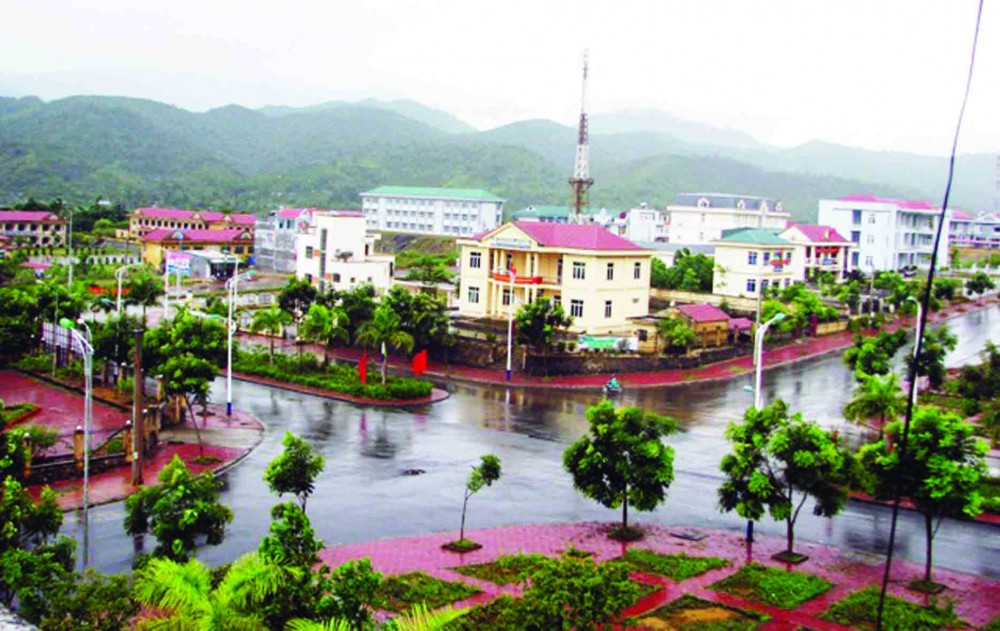
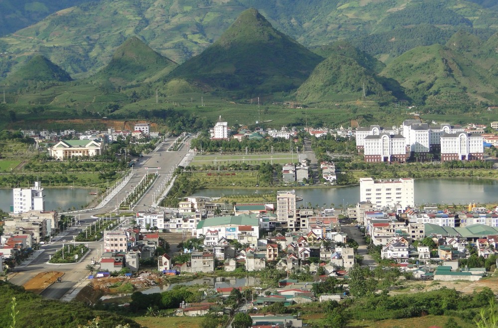
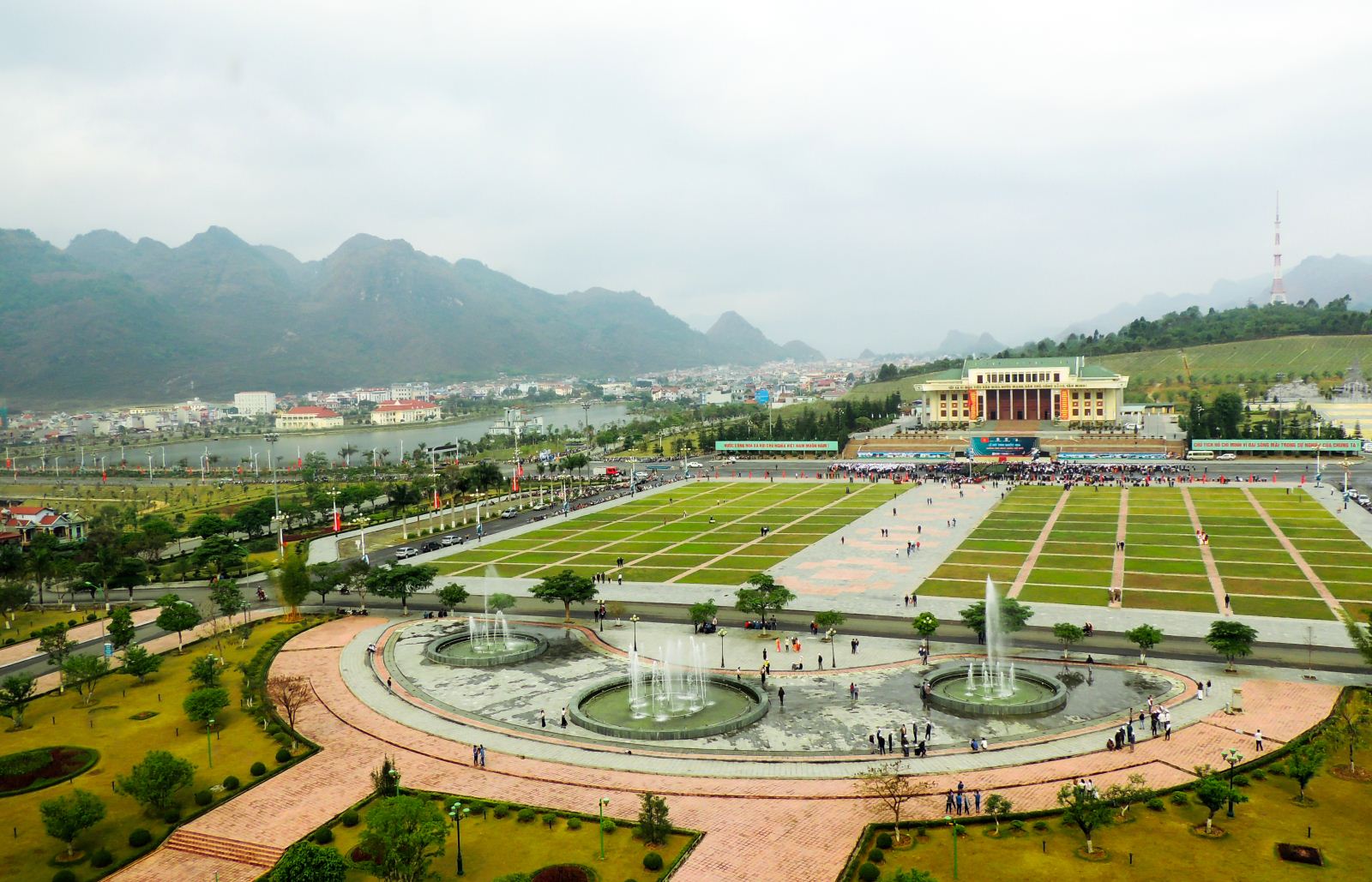
Lai Chau province is located in the northwest of Vietnam. The province shares its borders with Yunnan province (China) to the North, with other provinces of Lao Cai, Yen Bai, and Son La to the East and with Dien Bien to the West and Southwest. The province has a common border with China of 273 km in length.

Infrastructure

Natural resources: Feralit and alluvia are major kinds of soils found in Lai Chau. In general, the soils here are suitable for developing forestry, perennial industrial crops and cattle breeding. Besides, Lai Chau has many important minerals such as copper, lead, gold, coal in Na Sang, rare earth in Phong Tho district and Kaolin in Huoi Pha, etc.

Travel resources: Lining between Sa Pa and Dien Bien Phu which are two reputed tourist destinations, Lai Chau has large lake systems from hydroelectric power stations as well as grandiose sceneries. Moreover, Lai Chau owns a diversified culture created by 20 ethnic groups. With these advantages, Lai Chấu is considered to have a great potential for tourism development. Besides that, it is quite advantageous for the province to develop ecotourism, cultural tourism and sustainable agriculture because of having plate

Traffic: Transportation is Lai Chau is rather challenging due to its difficult topography. Roadway is the major means in the province. There are 5 national highways running through the province (National highways No. 12, 32, 4D, 279, 100 with the total length of 216 km). National highway no. 12 connects Dien Bien Phu city with China (through Ma Lu Thang border gate). National 4D connects to Sa Pa town of Lao Cai province. In 2010, there were 97 communes having motorway reaching centers.

Power system: Electricity grid was combined of different lines including 110, 35, 22, 10 and 0.4 KV and transformer systems. The 110KV line is 87km long; the 35KV line: 688km; the 22KV line: 0.16km; the 10KV line: 5.9km; the 0.4KV line: 408km. There are two 110KV substations with the total capacity of 16,000KV; a 35/6KV substation with capacity of 48.429 KVA; a 22/0.4 KV substation with capacity of 10KVA; 6 10/0.4 KV substations with the total capacity of 920KVA; a 04/10KV substation with capacity of 1,120K

Water system: Water supply works mainly meet a water demand in urban areas. In 2010, urban water supply works was installed in 5 out of 7 towns and over 80% civil population is supplied with clean water

Post and Telecommunication Systems: Communication network was improved gradually. Broadband Internet service was installed in all 7 districts of the province. There are also 68 post offices in 2010 that increases by 9.3% compared to 2005.

Economic overview

GDP growth rate 2021: 3.41%

Investment situation

Up to now, Lai Chau has 1 FDI projects with the total investment capital is about 1.5 million US dollars.

Attraction fields

Hydropower, agro-forestry processing, construction materials, mineral exploitation, traditional handicraft, infrastructure development, tourism,

Contact information

LAI CHAU DEPARTMENT OF PLANNING AND INVESTMENT
Add: Administrative Centre, Tan Phong Ward, Lai Chau Town
Tel: (84-231) 3.876.501 l Fax: (84-231) 3.876.437
Email:   so.kh&dt-laichau@chinhphu.vn

MA LU THANG BORDER GATE ECONOMIC ZONES AUTHORITY OF LAI CHAU PROVINCE
Add: Km 0, Pa Nam Cum Area, Ma Ly Pho ward, Phong Tho District, Lai Chau province
Tel: 0213.3911368, Fax: 0231.3911378
Email: hcth.ktck.laichau@gmail.com

DOCUMENTS

63 PROVINCES & CITIES

Ha Noi

Ha Noi

Area: 3,324.5 km2
Population: 8,246,500
Da Nang

Da Nang

Area: 1,285.4 km2
Population: 1,134,310
Ho Chi Minh City

Ho Chi Minh City

Area: 2,095.5 km2
Population: 9,077,158
An Giang

An Giang

Area: 3,536.7 km2
Population: 1,904,532
Ba Ria - Vung Tau

Ba Ria - Vung Tau

Area: 1,989.5 km2
Population: 1,148,313
Bac Giang

Bac Giang

Area: 3,849.5 km2
Population: 1,875,238
Bac Kan

Bac Kan

Area: 4,859.4 km2
Population: 314,039
Bac Lieu

Bac Lieu

Area: 2,468.7 km2
Population: 918,207
Bac Ninh

Bac Ninh

Area: 822,7 km2
Population: 1,462,945
Ben Tre

Ben Tre

Area: 2,359.8 km2
Population: 1,288,463
Binh Dinh

Binh Dinh

Area: 6,050.6 km2
Population: 1,487,009
Binh Duong

Binh Duong

Area: 2,694.4 km2
Population: 2,627,195
Binh Phuoc

Binh Phuoc

Area: 6,871.5 km2
Population: 994,679
Binh Thuan

Binh Thuan

Area: 7,813.1 km2
Population: 1,230,808
Ca Mau

Ca Mau

Area: 5,294.9 km2
Population: 1,218,000
Can Tho

Can Tho

Area: 1,408.9 km2
Population: 1,250,792
Cao Bang

Cao Bang

Area: 6,703.4 km2
Population: 533,086
Dak Lak

Dak Lak

Area: 13,125.4 km2
Population: 1,869,322
Dak Nong

Dak Nong

Area: 6,515.6 km2
Population: 622,168
Dien Bien

Dien Bien

Area: 9.560 km²
Population: 613,500
Dong Nai

Dong Nai

Area: 5,907.2 km2
Population: 3,097,107
Dong Thap

Dong Thap

Area: 3,378.8 km2
Population: 1,693,300
Gia Lai

Gia Lai

Area: 15,536.9 km2
Population: 1,541,829
Ha Giang

Ha Giang

Area: 7,914.9 km2
Population: 854,679
Ha Nam

Ha Nam

Area: 862 km2
Population: 883,927
Ha Tinh

Ha Tinh

Area: 6,055.6 km2
Population: 1,288,866
Hai Duong

Hai Duong

Area: 1,656 km2
Population: 1,936,774
Hai Phong

Hai Phong

Area: 1,527.4 km2
Population: 2,028,514
Hau Giang

Hau Giang

Area: 1,602.4 km2
Population: 726,792
Hoa Binh

Hoa Binh

Area: 4,608.7 km2
Population: 854,131
Hung Yen

Hung Yen

Area: 926 km2
Population: 1,269,090
Khanh Hoa

Khanh Hoa

Area: 5,217.7 km2
Population: 1,231,107
Kien Giang

Kien Giang

Area: 6,348.5 km2
Population: 2.109.000
Kon Tum

Kon Tum

Area: 9,689.6 km2
Population: 561,742
Lai Chau

Lai Chau

Area: 9,068.8 km2
Population: 460,196
Lam Dong

Lam Dong

Area: 9,773.5 km2
Population: 1,415,500
Lang Son

Lang Son

Area: 8,320.8 km2
Population: 781,655
Lao Cai

Lao Cai

Area: 6,383.9 km2
Population: 730,420
Long An

Long An

Area: 4,495 km2
Population: 1,688,547
Nam Dinh

Nam Dinh

Area: 1,653.2 km2
Population: 1,826.269
Nghe An

Nghe An

Area: 16,490 km2
Population: 3,327,791
Ninh Binh

Ninh Binh

Area: 1,377.6 km2
Population: 993,920
Ninh Thuan

Ninh Thuan

Area: 3,358.3 km2
Population: 595,000
Phu Tho

Phu Tho

Area: 3,533.3 km2
Population: 1,463,726
Phu Yen

Phu Yen

Area: 5,060.6 km2
Population: 961,152
Quang Binh

Quang Binh

Area: 8,065.3 km2
Population: 895,430
Quang Nam

Quang Nam

Area: 10,438.4 km2
Population: 1,495,812
Quang Ngai

Quang Ngai

Area: 5,152.7 km2
Population: 1,246,000
Quang Ninh

Quang Ninh

Area: 6,102 km2
Population: 1,321,149
Quang Tri

Quang Tri

Area: 4,739.8 km2
Population: 632,375
Soc Trang

Soc Trang

Area: 3,311.6 km2
Population: 1,621,000
Son La

Son La

Area: 14,174.4 km2
Population: 1,248,415
Tay Ninh

Tay Ninh

Area: 4,032.6 km2
Population: 1,178,329
Thai Binh

Thai Binh

Area: 1,570.8 km2
Population: 1,860,447
Thai Nguyen

Thai Nguyen

Area: 3,533.2 km2
Population: 1,307,871
Thanh Hoa

Thanh Hoa

Area: 11,129.5 km2
Population: 3,664.900
Thua Thien Hue

Thua Thien Hue

Area: 5,033.2 km2
Population: 1,133.700
Tien Giang

Tien Giang

Area: 2,509.3 km2
Population: 1,772,785
Tra Vinh

Tra Vinh

Area: 2,341.2 km2
Population: 1,009,168
Tuyen Quang

Tuyen Quang

Area: 8,065.3 km2
Population: 784,811
Vinh Long

Vinh Long

Area: 1,520.2 km2
Population: 1,022,791
Vinh Phuc

Vinh Phuc

Area: 1,237.5 km2
Population: 1,151,154
Yen Bai

Yen Bai

Area: 6,886.3 km2
Population: 876,041

Provincial Investment Promotion Agencies